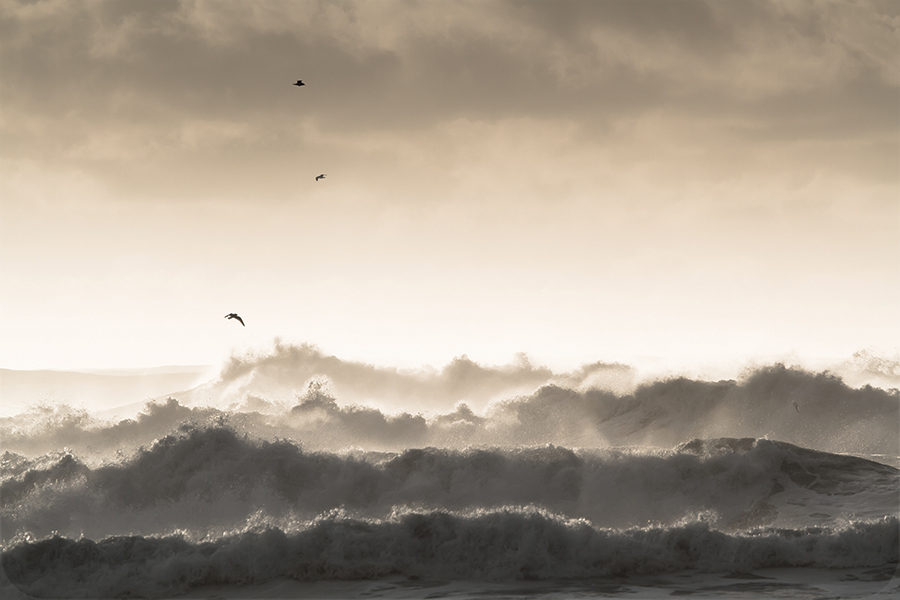
It’s easy to love the beach on a sunny day. But what about when a powerful storm roars in from the Pacific Ocean — nature in uncontrolled chaos? The fact is, the Washington Coast is fascinating regardless of the weather, every single day of the year.
When the storm winds blow in from an angry sea, the sheer spectacle can be almost astonishing.
As Kipling put it more than 100 years ago in The Sea and the Hills:
“Who hath desired the sea? — the sight of saltwater unbounded —
The heave and the halt and the hurl and the crash of the
comber wind-hounded?
The sleek-barrelled swell before storm, grey, foamless, enormous,
and growing—
Stark calm on the lap of the Line or the crazy-eyed hurricane blowing—”
AP Photo/National Park Service
That happens here, regularly. The Washington Coast is on the tail end of one of the most climatically tempestuous regions on the planet — from the Gulf of Alaska south along the Northwest Coast. Every year visitors and locals alike get the opportunity to really experience the power of the largest body of water anywhere, the mighty Pacific Ocean.
The wind here can really scream and howl. Swells and waves crash and explode upon shoreline rocks. The rain, well, you know. It pounds, plummets, pummels. It’s all fun to watch.
“Severe weather is something people find extremely interesting,” says University of Washington climate guru Cliff Mass (he’s actually a professor of atmospheric sciences), who writes a popular weather blog.
“I think it’s sort of like a religious experience. People tend to be in awe of a force that is bigger than themselves. It is tremendously exciting to experience that power.”
 As any avid adventurer along the Washington Coast knows well, timing is everything. Weather is a controlling factor in whatever you want to do along our coast. Storms and steelhead angling in our rainforest rivers don’t really mix. Rivers get high and dirty, the fishing is no good. Razor clamming too. You don’t really want a storm for digging, the clams won’t show and it can get dangerous when swells are big.
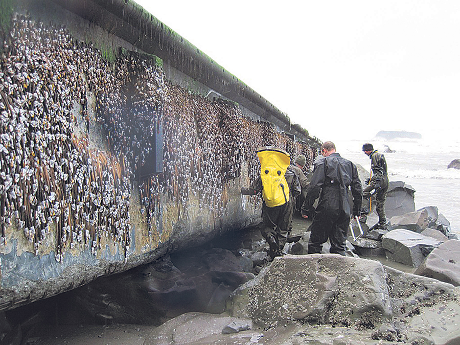
On the other hand, there’s a magic time on the shoreline right after a big storm. Swells continue for a spell, so the surf remains lively, but you can get out and hike without being blown sideways or getting saturated by sheets of rain. Beach-combing is best post-blow, since storms push in things like glass fishing floats, crab pots, crab pot floats, curious bottles — even things like coconuts. The crashing waves churn up the beach gravels and improve agate hunting, and sometimes they uncover old shipwrecks and such.

Aaron Lavinsky
If you’ve got the flexibility, watch the forecasts (see the accompanying list of weather web sites) and try to time your trip toward the end of the storm track. Then you can witness nature’s fury and the rewarding results.
Speaking of rewards, weather professor Cliff Mass thinks towns along the Washington Coast are missing the boat on some.
“I get emails all the time from people who want to go storm-watching,” he says. “The Oregon Coast gets a lot of that. But the Washington Coast is closer to us here, the biggest population center in the Northwest. And, economically, things are not great on our coast.”
He has pitched a vision for some sort of storm-watching museum or interpretive center — say in Ocean Shores or Long Beach — that would explain how our often stormy weather is the manifestation of the region’s geography and geo-physical history. It could include exhibits on shipwreck history, beach erosion (think Washaway Beach near the Grays Harbor/Pacific County line) versus accretion (think Damon Point at Ocean Shores), tsunamis, plate tectonics and subduction quakes. Geologically speaking, this coast is a very active place.
“That’s the vision anyway,” says Mass. “I’m convinced you could have a really compelling place.”
But he says his suggestion has fallen on the deaf ears of local leaders.
At the same time, there are already ample and terrific places to stay during Poseidon’s regular outbursts on the Washington Coast. There’s cool history to experience and great beaches to hike when the weather abates, or is at least tolerably miserable. (I carry full rain gear).
Storm Sense: Staying Sane and Safe
You really need to watch out while storm-watching. The raw beauty of a powerful storm crashing in from the sea can be mesmerizing, and people often seem to want to be part of it.
I’ve seen it more than once: people standing on the edge, snapping selfies as the storm sends waves and spray crashing overhead.
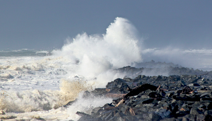 In February of 2010 during a storm pushing 18-foot swells, I watched at least a dozen folks in rain gear standing atop the Grays Harbor north jetty being sluiced by the sea. To them it must have seemed like harmless fun. Then one particularly large wave broke over the jetty and knocked two men into the rocks below. One of them fractured his leg.
Savvy storm-watchers know that nature is indifferent. It can stun you with its beauty one moment and stun you dead the next.
Here are a few tips to keep you safe.
Do not stand on any jetty or rocks or seawalls during a big blow. If the briny sea is crashing up there, watch from a safe distance.
Take care during high tides and around drift logs. When the tide is up, it can trap you around bluffs and carry you away. A raging surf can roll two-ton logs faster than a big-legged logger in a mill pond. Don’t tempt fate by hiking the beach when the high tide sends the surf crashing into the driftwood.
Never turn your back to a big surf; you never know when a rogue wave will roll in.
Don’t get lit up by being outside when lightning is flashing. Retreat to your favorite beachside bar, so you can watch the storm while getting a safe buzz.
Storm Watching Locations
Long Beach Peninsula
The 28-mile finger of sand on the south Washington Coast is full of fine ocean-view hotels and loaded with great places to dine (the Depot, Shelburne Inn, Nanci & Jimella’s and others).
But what blows me away is the best state park on the entire Washington Coast, Cape Disappointment (www.parks.wa.gov/486/Cape-Disappointment). Its rocky ramparts provide prime, easy-to-reach spots to watch “the halt and hurl of the comber wind-hounded.”
A weather station there at North Head in 1921 recorded gusts of more than 120 miles per hour — until the wind gauge was blown off its base. The North Head Light is an historic structure and is reached just a few skips away from its parking area — don’t bother with an umbrella, wear rain gear!
The park’s Lewis & Clark Interpretive Center is perched on Cape Disappointment above the Columbia River north jetty, a great spot to watch the sun sink into the seemingly endless sea. Stormy weather is also a perfect occasion to take in the center’s intriguing exhibits. If it’s not too nasty out, the half-mile hike from there to the historic Cape D Lighthouse (circa 1853) is most worthwhile. Another fine short hike in the park is the Bells View Trail, which also starts at the North Head parking area.
My favorite storm-watching watering hole on the peninsula? The Pickled Fish restaurant atop the Adrift Hotel in Long Beach provides a fine view of the surf.
Pacific Beach Area
Three of what I would call traditional ocean resorts — the Sandpiper, Iron Springs and Ocean Crest — make this area Storm-Watch Central on the Washington Coast. Throw in the newer, upscale resort Seabrook and you’ve got ample accommodation in a stretch of some 10 miles.
The Sandpiper sits basically right on the uplands above the surf. Iron Spring’s bluff-top cabins were completely renovated two years ago. Ocean Crest has rebuilt its quaint restaurant after a fire a few years ago, and most say it is even better than before.
A great beach-combing hike nearby? Copalis Spit at Griffiths-Priday State Park (www.parks.wa.gov/516/Griffith-Priday-Ocean), where vehicles are not allowed anytime (although I have seen post-storm tire tracks there).
I’m also partial to the Green Lantern Tavern at Copalis Beach. A few years ago four of us stopped in toward the end of a blow, played pool and enjoyed ales and burgers while watching trees floating down the swollen Copalis River — my style of storm-watching!
Kalaloch
The bluff-top cabins at Kalaloch Lodge and resort are super cozy during a storm — or anytime — and Olympic National Park’s nearby Kalaloch Campground has sites with tremendous views of the ocean if you travel in a comfy RV.
Several years ago I checked in the family at a Kalaloch cabin during a storm with 40-knot gusts. At dawn the storm had broken, so I pulled on my hiking boots and hit Beach Four. A half-hour’s hike north revealed a basketball-sized green glass float resting on the high tide line and plenty other interesting flotsam. The float now graces my garden.
All the Kalaloch-area beaches are pristine and superb for hiking (www.nps.gov/olym/planyourvisit/visiting-kalaloch-and-ruby-beach.htm), and those from Beach Three north especially are exquisite.
The lodge’s restaurant provides an appropriately moody view down the mouth of Kalaloch Creek to the ocean, a fine warm spot in a storm.
La Push
The Quileute Nation (www.quileutenation.org/) operates a fine resort on scenic First Beach, Quileute Oceanside Resort, and it serves as a fine base for exploring the La Push area’s superb Olympic National Park beaches. Rialto Beach (www.nps.gov/olym/planyourvisit/rialto-beach.htm), on the north bank of the Quillayute River, offers an accessible path from the parking area to the surf — which in my experience is especially growly here, perhaps owing to the steep, gravelly nature of the shore.
If the weather is not too insistent, the 1.6-mile hike from Rialto Beach to sea stack-strewn Hole in the Wall is one of the finest on the entire Washington Coast. Another absolute gem near La Push is Second Beach (www.nps.gov/olym/planyourvisit/second-beach-trail.htm); it’s 0.7 miles to the stunning beach between impassable Teahwhit Head and Quateata heads, with sea arches on both sides. You’ll also see the northern corner of the lithic sea-stack kaleidoscope known as the Giant’s Graveyard.
–G.J
Always topical blog site of University of Washington atmospheric sciences Professor Cliff Mass http://cliffmass.blogspot.com
National Weather Service Seattle, click on map at appropriate location for forecast and/or click on offshore locations for marine forecast, with predicted swell heights, wind speeds, etc.
www.wrh.noaa.gov
Department of Ecology’s Washington Coastal Atlas, for information and photos of all the state’s marine shoreline
https://fortress.wa.gov/ecy/coastalatlas/tools/ShorePhotos.aspx
UW Radar Viewer www.atmos.washington.edu/weather/radar.shtml
UW Probability Forecast http://probcast.washington.edu/
Federal tide forecasts for Washington http://tidesandcurrents.noaa.gov/tide_predictions.html?gid=259
Washington Coast Magazine is published by The Daily World, a division of Sound Publishing and may not be reproduced without express written permission, all rights reserved.
